Gallery containing public domain photos of lakes, rivers and falls from the Canadian National Parks – Western Canada. Canada has an extremely large number of lakes. The number of lakes larger than three square kilometers is estimated at close to 31,752 by the Atlas of Canada, with 561 lakes with a surface area larger than 100 km2. Almost 9% (891,163 square kilometers (344,080 sq mi)) of Canada’s total area is covered by freshwater.


Sherbrooke Lake is a lake in Yoho National Park, British Columbia, Canada. The lake can be reached by following a three km hiking trail that begins from the Trans-Canada Highway across from Wapta Lake. Sherbrooke Lake also serves as an access point for mountaineering access to the Waputik Icefield and the Scott Duncan Hut.
Panther Falls are a series of waterfalls in Banff National Park, Alberta, Canada. It is developed on Nigel Creek and its waters originate in Nigel Pass, between the slopes of Cirrus Mountain and Nigel Peak in the Parker Ridge of the Canadian Rockies. It is a class 3 waterfall, with a drop of 200 ft (61 m) and a width of 25 ft (7.6 m).


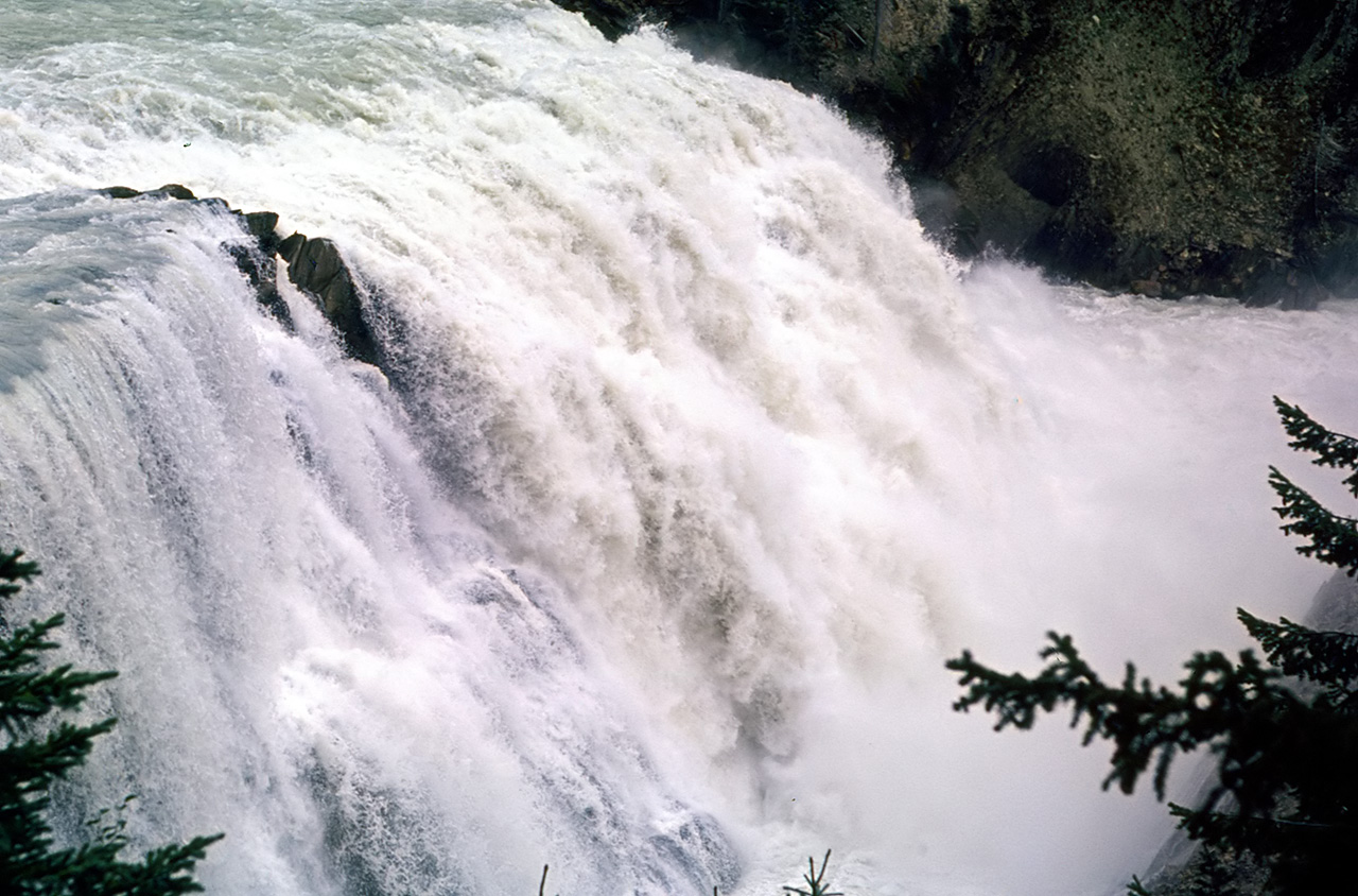
Wapta Falls is a waterfall located in Yoho National Park in British Columbia, Canada. It is the largest waterfall of the Kicking Horse River, at about 30 metres high and 150 metres wide. Its average flow can reach 254 cubic metres per second. The name stems from a Nakoda native word meaning “river”.
The Saskatchewan River is a major river in Canada, approximately 550 km (340 mi) long, flowing roughly eastward across Saskatchewan and Manitoba to empty into Lake Winnipeg. The river and its tributaries provided an important route of transportation for First Nations and early European trappers. Hydroelectric power plants are built on the river at Nipawin, and E.B. Campbell Dam (formerly Squaw Rapids) in Saskatchewan and at Grand Rapids in Manitoba.
Fish species include: walleye, sauger, yellow perch, northern pike, lake whitefish, mooneye, goldeye, white sucker, longnose sucker, shorthead redhorse, burbot, rainbow trout, brown trout and lake sturgeon. First Nations inhabiting the area of the rivers included at one time or another the Atsina, Cree, Saulteaux, Blackfoot Confederacy, Assiniboine, and Sioux.


Takakkaw Falls is a waterfall located in Yoho National Park, near Field, British Columbia, in Canada. Its highest point is 384 metres (1,260 ft) from its base, making it the second-highest officially measured waterfall in western Canada, after Della Falls on Vancouver Island. However its true “free-fall” is only 254 metres (833 ft). “Takakkaw”, loosely translated from Cree, means something like “it is magnificent”. The falls are fed by the Daly Glacier, which is part of the Waputik Icefield.
imcphoto
I'm a photography enthusiast with a passion for classic film cameras and writing. I believe that photography is a powerful tool for storytelling and I strive to create images that are evocative and meaningful. I hope you enjoy my work!